Advertiser Disclosure

Many of the credit card offers that appear on this site are from credit card companies from which we receive financial compensation. This compensation may impact how and where products appear on this site (including, for example, the order in which they appear). However, the credit card information that we publish has been written and evaluated by experts who know these products inside out. We only recommend products we either use ourselves or endorse. This site does not include all credit card companies or all available credit card offers that are on the market. See our advertising policy here where we list advertisers that we work with, and how we make money. You can also review our credit card rating methodology.

The 3 Best Navigation Apps I Use When Traveling to New Destinations

Christine Krzyszton's image
Christine Krzyszton
Christine Krzyszton's image

Christine Krzyszton

Senior Finance Contributor

326 Published Articles

Countries Visited: 98U.S. States Visited: 45

Christine ran her own business developing and managing insurance and financial services. This stoked a passion for points and miles and she now has over 2 dozen credit cards and creates in-depth, deta...
Edited by: Michael Y. Park
Michael Y. Park's image

Michael Y. Park

Editor

27 Published Articles 347 Edited Articles

Countries Visited: 60+U.S. States Visited: 50

Michael Y. Park is a journalist living in New York City. He’s traveled through Afghanistan disguised as a Hazara Shi’ite, slept with polar bears on the Canadian tundra, picnicked with the king and que...

We may be compensated when you click on product links, such as credit cards, from one or more of our advertising partners. Terms apply to the offers below. See our Advertising Policy for more about our partners, how we make money, and our rating methodology. Opinions and recommendations are ours alone.

I enjoy traveling to different countries, having new experiences, and learning about the area and people living there. There is, however, one element of travel I always used to dread.

It was that late-night arrival in an unfamiliar city. I would be exiting the airport or train station, attempting to navigate the sea of transportation options, and aiming to make a prudent decision, all while tired from a long journey.

Traveling internationally presents several unique navigational challenges, but with the help of technology, getting from Point A to Point B has become routine, even enjoyable.

Because I’m not a tech expert, I often look for simple tools I can use to solve my travel-related navigational issues. Here are 3 basic, easy-to-use, navigation tools that make it easy to get where I need or want to be.

Rome2Rio

Rome2Rio
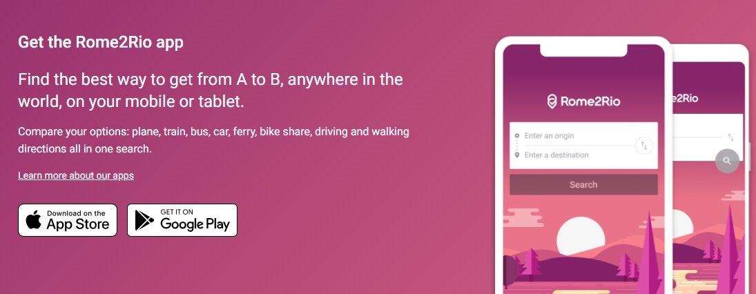
Rome2Rio helps me get to my destination no matter where I am worldwide. Image credit: Rome2Rio

To help resolve the most dreaded part of my journey, the late-night airport arrival, I searched for an app showing all the transportation available between 2 points. Knowing the estimated associated costs of the journey was a plus.

Then I found Rome2Rio. Here’s why I love the site and the app.

How It Works

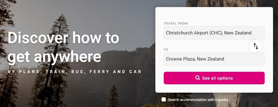
Rome2Rio Get Started
Rome2Rio searches all the options available to get me to my destination. Image Credit: Rome2Rio

Rome2Rio (iOS, Android) works worldwide. The app accesses over 6,000 train operators, nearly a million bus routes, over 13,000 ferries, and over 1,100 airlines to find the transportation options available between 2 points.

Once downloaded, you can type in your desired departure and destination and receive all the transportation options between those 2, or more, points. The Rome2Rio website can also be used online without downloading the app.

Best of all, Rome2Rio will let you know the estimated cost of each method of travel so you can compare. Booking links for most transportation options are also provided, as well as hotel suggestions.

How I Use Rome2Rio

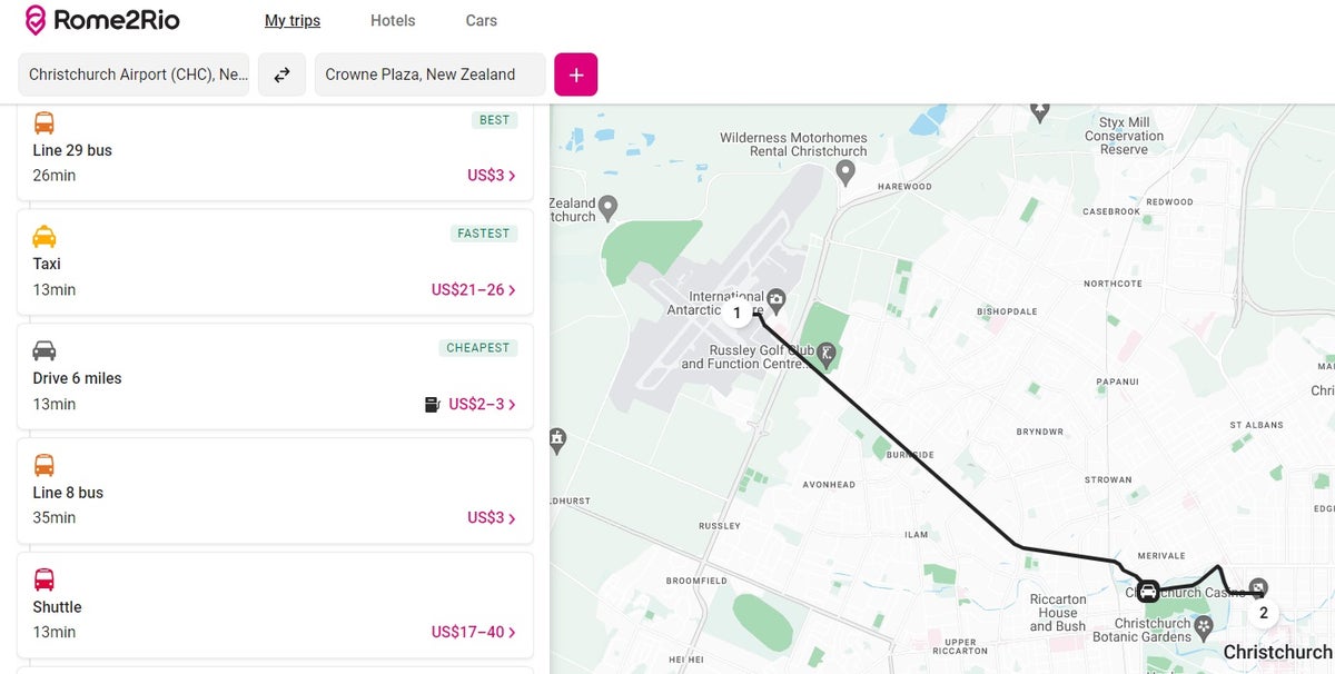
Rome2Rio Christchurch Airport to Hotel
Knowing the estimated costs of transportation saves me money. Image Credit: Rome2Rio

Getting from the airport to my hotel was my primary use of Rome2Rio. For example, I wanted to travel from the Christchurch, New Zealand, airport to my hotel. Knowing that a taxi would cost me $21 to $25 helped me tremendously. I could then compare it to Uber, or if that price range isn’t acceptable, I could select another less expensive option.

This knowledge can also help me confidently secure transportation without being overcharged.

Once I click a transportation option, Rome2Rio gives me all the details. For example, the bus option shows me the ticket cost, route numbers, connecting bus information, walking distance (if applicable), and arrival and departure times.

I also use Rome2Rio to find transportation between cities and even countries.

Bottom Line:

I use the Rome2Rio app to find transportation and their estimated costs between worldwide departure and destination points. The app also includes booking links for most transportation.

Google Maps

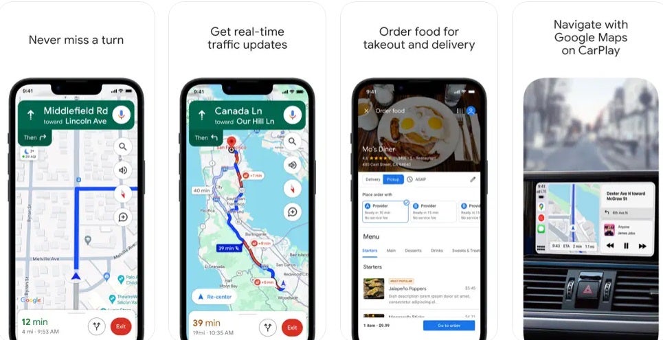
Google Maps Screenshots
Google Maps is loaded with helpful navigation information. Image Credit: Google

Google Maps is the No. 1 navigation tool available with approximately 1.8 billion people using it monthly.

How It Works

Google Maps Directions
Google Maps provides directions to any location. Image Credit: Google

Google Maps (iOS, Android) uses an internet connection to access a GPS satellite system to calculate and provide directions. It’s much more technical than that, but, as a user, that’s all I need to know.

You can get Google Maps directions to an address, business, or other destination. When you select directions, Google Maps will display different ways to get there.

The key requirement is that Google Maps needs the internet to access its data. Once you’ve downloaded directions, though, you can use them offline.

How I Use Google Maps

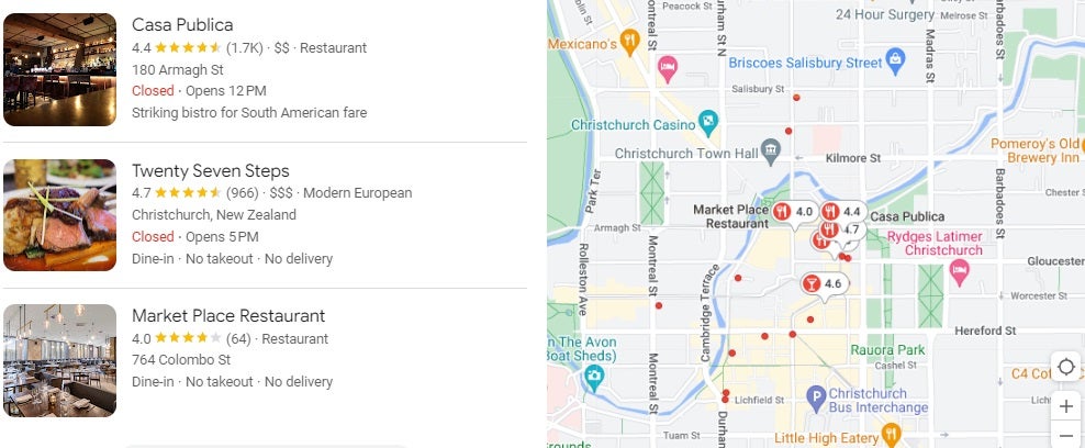
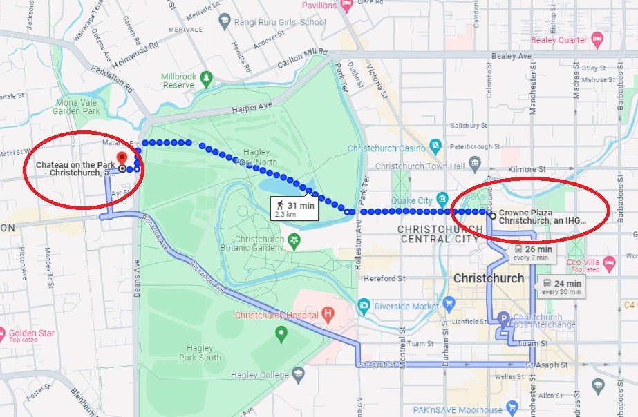
Google Maps Christchurch
Google Maps is my go-to for navigating a city on foot. Image Credit: Google

My most common use of Google Maps is for walking directions. I want to know if I can walk to my new hotel from my current hotel, find a supermarket nearby, or perhaps a restaurant within walking distance that serves fish.

A simple Google search for any of these brings up a map of the area around me. I then select and download walking directions to my destination and am on my way.

The directions function, even offline, until I reach my destination. I then need Wi-Fi to use Google Maps again. With SIM card Wi-Fi access, this isn’t an issue.

I’ve found that downloading Google Maps directions to use offline later works somewhat in an urban area and not so much in remote areas.

Bottom Line:

I frequently use Google Maps for walking directions within a city. The tool needs internet access to populate the directions, but once on my phone, I can use those directions offline until I reach my destination. Google Maps directions can also be downloaded ahead of time and used offline.

Maps.me

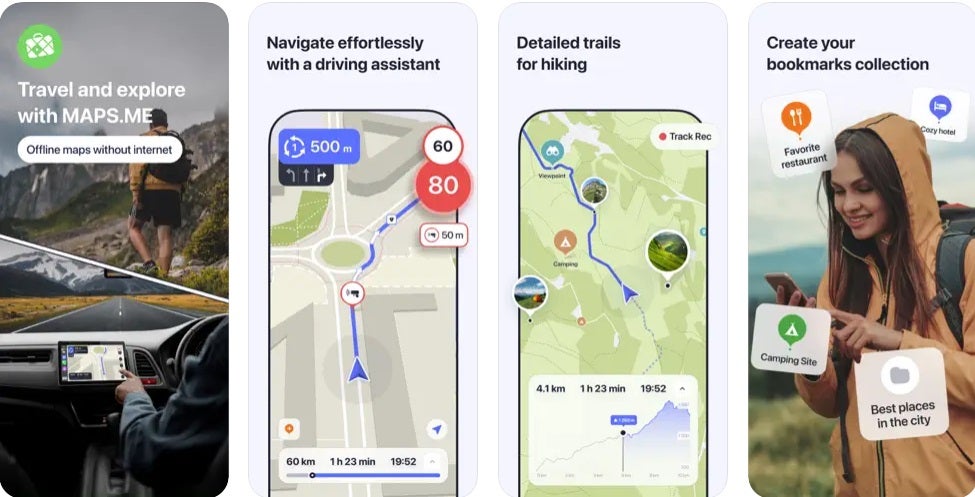
Maps.me Screenshot
Remote locations can be navigated using Maps.me. Image Credit: Apple

Maps.me (iOS, Android) allows me to download area maps while connected to the internet and use them offline later. This function can be useful, especially in a remote area.

How It Works

The app is free to use and has downloadable city and country maps. You can also subscribe for a fee to receive enhanced maps or download more than 10 maps.

The app works well for obtaining driving directions, navigating a city on foot without Wi-Fi access, following your trip when in a taxi, or using public transport. If you enjoy hiking, downloading Maps.me offline maps can be useful.

How I Use Maps.me

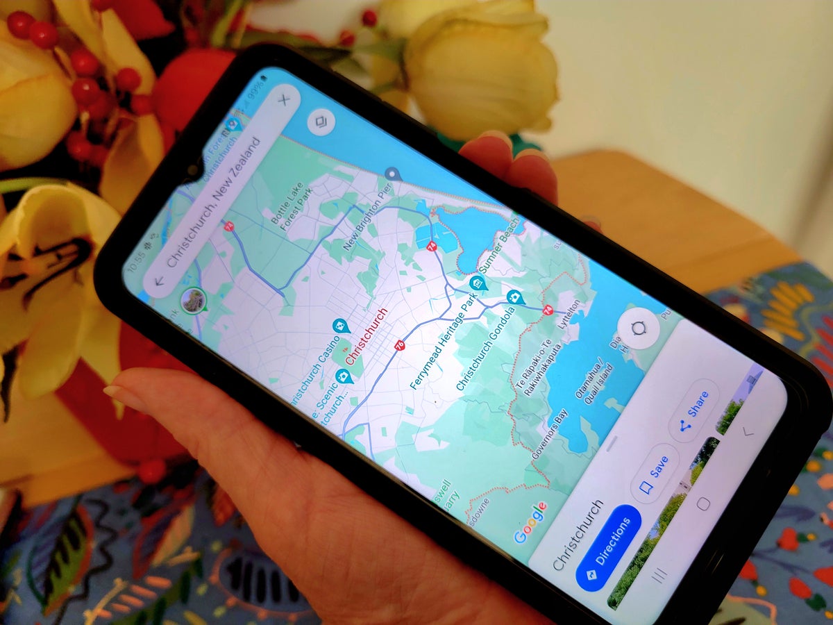
1000000045
Maps.me gives me free access to offline maps worldwide. Image Credit: Christine Krzyszton

Maps.me is my backup tool when Google Maps isn’t the best option . While in Christchurch, New Zealand, for example, I downloaded a map and accessed it to walk around the city.

Maps.me maps also worked well in Torshavn, Faroe Islands. Though Google Maps would have easily guided me to my destination, I wanted a new route back to my hotel. Even without the internet, Maps.me displayed an alternative route.

One downside to Google Maps is that the map can’t be accessed without the internet once I’ve reached my destination using the provided directions. Even when I’ve downloaded Google Maps to use offline, Maps.me maps worked substantially better offline in my experiences over about a dozen uses.

Bottom Line:

Maps.me allows me to download a city (or country) map and use it to navigate while offline. It works better than Google Maps when I am in a remote area without access to the internet.

Final Thoughts

For many of you, these simple navigational tools may be old news. For me, these are essential tools that offer an ongoing lifeline.

They allow me to navigate a new city I’m visiting for only a day without purchasing a $20 SIM card or accessing my international phone plan. The information gives me the confidence to negotiate solo transportation with an unknown taxi driver late at night, find that communist-era dive bar, or discover a shortcut back to my hotel in the dark.

Rome2Rio, Google Maps, and Maps.me have helped me navigate simply in a complicated world.

Frequently Asked Questions

If Maps.me free?

Yes, Maps.me is free to use and to download up to 10 maps. You can also subscribe for enhanced maps and more than 10 map downloads. The cost is around $10 per month.

What is Rome2Rio?

Rome2Rio is a travel tool that displays transportation options between any given Point A and Point B. The tool also shows the estimated costs, booking links, and lodging.

Can I use Google Maps offline?

Yes, you can download a Google Map while online and use it offline. I found this worked better in urban areas than remote.

Are Rome2Rio prices accurate?

Having used Rome2Rio for over 7 years and on most of my trips, I have found the pricing information to be fairly accurate. I remember just 2 incidents where the taxi prices were way off. In one case, it was an obvious currency conversion issue. I use the information as a general guideline. Since, bus, train, and ferry fares are real-time booking information, they are accurate.

Does Rome2Rio show Uber prices?

Not always. When available, ride-share information may be included.

Christine Krzyszton's image

About Christine Krzyszton

Christine ran her own business developing and managing insurance and financial services. This stoked a passion for points and miles and she now has over 2 dozen credit cards and creates in-depth, detailed content for UP.

INSIDERS ONLY: UP PULSE

Deluxe Travel Provided by UP Pulse

Get the latest travel tips, crucial news, flight & hotel deal alerts...

Plus — expert strategies to maximize your points & miles by joining our (free) newsletter.

We respect your privacy. This site is protected by reCAPTCHA. Google's privacy policy  and terms of service  apply.

Deluxe Travel Provided by UP Pulse
DMCA.com Protection Status